Neue Zahlungsoptionen am Kassenautomaten in der Kreisverwaltung
Bitte beachten Sie:
Die Bezahlung mit Kreditkarte, mit Smartphone oder Smartwatch ist am Kassenautomat ab sofort möglich (Debit, VISA, Mastercard, Maestro)!
Beim kontaktlosen Bezahlen durch Auflegen der Karte ist bitte das akustische Signal abzuwarten.
Sprechzeiten Führerschein- und Zulassungsbehörde
Bitte beachten Sie:
Vorgänge im Zusammenhang mit dem Fahrzeug-Zulassungswesen sowie Führerscheinangelegenheiten können ausschließlich nach Terminvereinbarung bearbeitet werden!

ASP-Bürgertelefon: 03562 986-13999
Montag bis Donnerstag: 08:00 bis 16:00 Uhr
Freitag: 08:00 bis 14:00 Uhr
E-Mail: kats-asp@lkspn.de
Wie können wir helfen?
Aktuelles aus dem Landkreis
26.04.2024 Nr. 100/2024
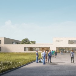
22. Zukunftstag in der Kreisverwaltung Spree-Neiße
26.04.2024 Nr. 99/2024
Gestalte deine eigene Naturapotheke mit den GeoKids
25.04.2024 Nr. 98/2024
Deckenerneuerung der Landesstraße L 50 von der Ortslage Fehrow/Prjawoz bis zur Bundesstraße B 168
Weitere Webseiten
Alle Pressemitteilungen